WhatsApp Image 2023-12-16 at 7.43.52 PM (2)

Atul Hiray & Associates

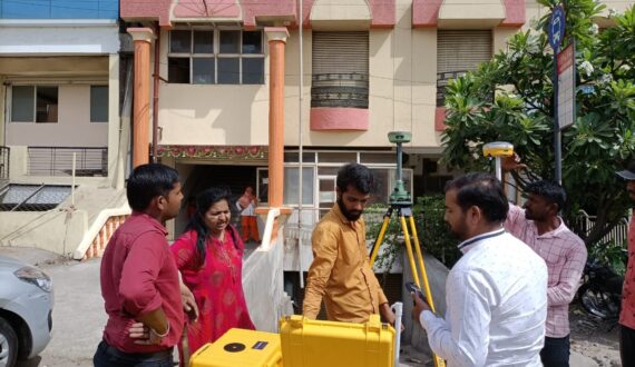
One of the reputed land survey, ISO:9001:2015 certified company in India, having more than 25 years of Experience in Survey Industry with all latest equipment’s and skill to support the survey activities in Land , Road , Railways , Lift Irrigation, Water Supply Schemes.

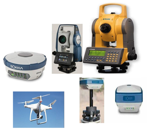
Atul Hiray & Associates has stayed abreast in technology by making investments in high precision Total stations and State of art Gyroscope equipment ( like Trimble & Sokiya ) & UAV-Drone technology.

Worked for government schemes such as Pant Pradhan Gram Sadak Yojna & Mukhyamantri Gram Sadak Yojana and Semi Government schemes in Punjab, Chandigarh, Chattisgarh, Gujarat, Rajasthan, U.P. State Government and private organizations.

540
+

Successful Projects

100
%

Our Satisfied Clients

3

Total Wining Awards

25

Professional Workers

Our Mission & Value

Our mission is to become the leader in Survey industry and provide the best and most accurate quality services in a timely manner using state of art advanced technology and well-trained manpower. We are proud of our experience in the field of land survey and consultancy.

Our values of honesty, integrity, commitment, and delivery are important to us. We are honest and straightforward in all of our dealings with clients, candidates, contractors, and our employees.

Our Achievements to name a few

  • 22000 kms Surveying, Estimation & Design of Rural Road in PMGSY scheme.
  • 2026 kms Geographical information survey of Nashik Municipal for Tata Infotech, data collection of PWD, SEWER & WATER SUPPLY Departments.
  • 100 kms L-Section survey for underground drainage scheme of Nashik Municipal for Wapco.
  • 50 kms laid pipeline survey of underground sewer lines for various contractors of Nashik Municipal.
  • 100 kms L-Section survey of water supply project for MJP of Syndicate services.
  • Surveying Estimation & Design of W.S,Schemes for 12 Villages.
  • 250 acres Block contour survey for IndoFrench Bio-tech project.
  •  Beed Parati & Igatpuri Railway Lineout.
  • Detailed Road Survey of Eight Lane Project from Mulund to Ghatkopar in Mumbai.
  •  Kiln Alignment work in Jamshedpur.
  •  Building Lineout of I.T.Parks & Various Critical Structures.
  •  300Nos of fixing Temporary Bench Marks.
  • 500 Acre Plot Demarcation.
  • Lineout of Ghoti Bypass Railway Over Bridge.
  • Plane Table & Contour Survey of 60 Slums in I.H.S.D.P. Project in Malegaon City.
  • UAV-Drone Survey for PWD of Matheran, Godavari River,Nashik & at Limdi – Gujarat

Our Firms

Atul Hiray & Associates

Nirmal Land Survey & Consultancy

Atul Civil Labs

Atul construction

Atul Drone Survey Services

Rd Drone Solutions

Machinery

  • Sokia FX 101
  • Sokia DX 101 AC
  • Trimble M3 DR 1
  • Topcon focus 5
  • GPS-GSX2 GNSS
  • UAV-Drones – Falcon

Software Expertise